Lines in the Sand: The World’s Most Bizarre and Historically Quirky National Borders
Explore Strange World Borders, uncovering the most unusual and quirky lines that define countries with fascinating histories and oddities.
Strange World Borders are unusual national boundaries shaped by historical events, natural features, and political decisions that create unique shapes, enclaves, and disputes worldwide.
Have you ever stumbled upon stories about Strange World Borders that make you wonder how such quirky lines took shape? From odd shapes to surprising histories, these borders tell tales beyond maps. Curious to explore?
The origins of strange world borders
The origins of strange world borders often trace back to unique historical events, treaties, and negotiations that seemed logical at the time but now appear odd or arbitrary. Many borders were drawn centuries ago, influenced by colonial powers, wars, and political compromises without clear regard for geography or local cultures.
Colonial Legacy and Arbitrary Lines
During the colonial era, European powers divided territories in Africa, Asia, and the Americas with little knowledge of local realities. They often drew straight lines on maps, ignoring natural features and ethnic groups, which resulted in bizarre shapes and disputed areas.
Wars and Treaties
Conflicts led to treaties where borders were redrawn rapidly as part of peace settlements. Sometimes, these borders followed rivers, mountains, or arbitrary latitudes and longitudes. In some cases, small enclaves or exclaves emerged due to complex negotiations.
Geographical and Cultural Influences
Natural landmarks like rivers and mountain ranges traditionally served as border markers. However, cultural and linguistic divisions also shaped boundaries, although sometimes unevenly. This mix led to borders that are both naturally and politically strange.
Understanding the history behind these borders reveals surprising stories of power struggles, compromises, and the lasting impact of decisions made long ago.
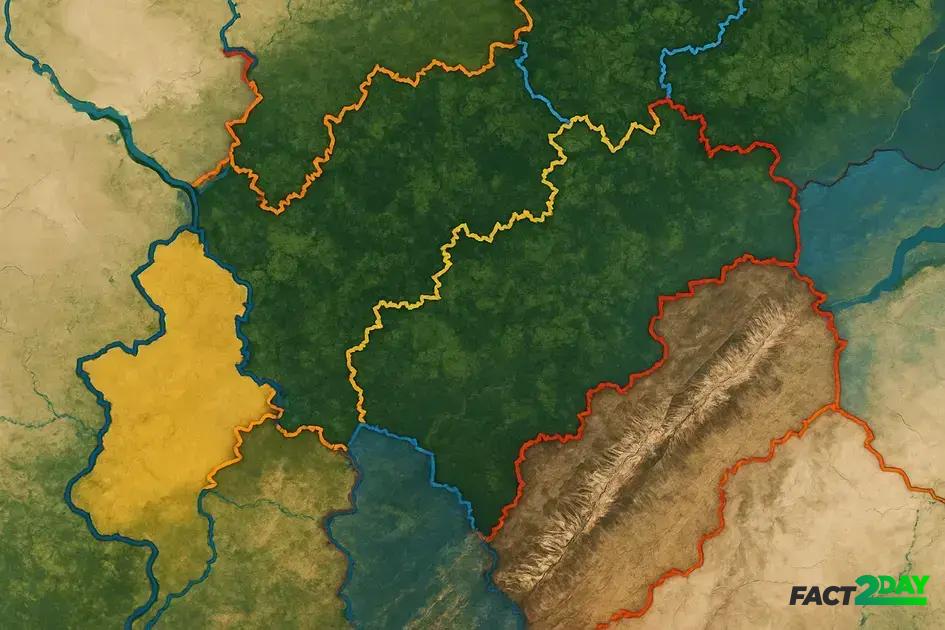
Unusual border shapes and demarcations
Unusual border shapes and demarcations often come from historical quirks and natural geography. Some borders zigzag through landscapes, while others form strange enclaves or separate communities unexpectedly.
Enclaves and Exclaves
These are territories of one country surrounded entirely by another. One famous example is Llivia, a small Spanish town completely surrounded by France. Such borders can cause political and logistical challenges.
Bizarre Lines Created by Natural Features
Rivers, mountains, and lakes sometimes form borders, but changes in these features can shift boundaries. The Rio Grande river between the US and Mexico is an example where natural shifts have complicated the border.
Straight Line Borders
Many African and Middle Eastern countries feature straight-line borders, a legacy of colonial powers dividing land with rulers on maps, ignoring the terrain and peoples on the ground. These result in sharp, geometric boundaries that look out of place on an otherwise natural landscape.
Understanding unusual border shapes helps explain why travel, trade, and politics can be unusually complex in these areas.
Historical events shaping quirky boundaries
Many quirky boundaries on the world map are the result of historical events that changed landscapes overnight. Wars, treaties, and power struggles often led to borders that seem illogical today but were practical compromises at the time.
The Treaty of Tordesillas
Signed in 1494, this treaty divided the New World between Spain and Portugal with a simple, straight north-south line. This arbitrary border ignored native populations and natural geography, creating long-lasting disputes.
The Partition of Africa
During the late 19th century, European powers carved up Africa with little regard for local tribes. The Berlin Conference drew straight borders and strange enclaves, some of which still cause tensions today.
The India-Pakistan Partition
In 1947, the hurried division of British India into India and Pakistan led to chaotic borders based on religion. The Radcliffe Line was drawn quickly, separating communities and creating enclaves, causing lasting conflicts.
These events illustrate how history shapes borders, often creating lines that don’t match people’s lives or the land they inhabit.
Natural features influencing border lines
Natural features have long played a key role in defining national borders. Mountains, rivers, and deserts often serve as natural barriers that make effective boundaries. These natural borders can be easier to defend and help separate distinct cultural or ecological regions.
Mountain Ranges as Borders
Mountains like the Himalayas and the Andes act as natural dividers between countries. Their rugged terrain makes crossing difficult, so nations have historically used them to mark limits. For example, the Himalayas separate India and China with a dramatic and high-altitude border line.
Rivers and Lakes Defining Boundaries
Rivers such as the Danube in Europe or the Rio Grande between the US and Mexico flow naturally between nations, making clear border lines. However, river borders can shift due to floods or changes in the watercourse, sometimes creating disputes.
Deserts and Other Barriers
Wide deserts like the Sahara have also been used to separate countries in North Africa. These harsh environments limit crossing points and thus create effective, if sometimes ambiguous, border zones.
While natural borders make sense geographically, they don’t always align neatly with people’s identities, leading to complex issues in border regions.
Border disputes fueled by odd boundaries
Odd boundaries often lead to border disputes that last decades or even centuries. When borders don’t follow clear natural landmarks or where enclaves and exclaves exist, conflict can easily arise between neighboring countries.
Disputed Territories and Clashing Claims
In many cases, overlapping claims result from unclear border definitions. The India-China border dispute in the Himalayas is a recent example where vague demarcations have led to military standoffs.
Enclaves Causing Political Complexity
Areas enclosed within another country, like the former India-Bangladesh enclaves, created confusion over governance and services. Only recently were many enclaves exchanged to reduce tension.
Resource-Driven Disputes
Odd borders can split valuable natural resources like rivers, minerals, or oil fields, sparking disputes. The Sudan-South Sudan border conflict involves oil-rich regions divided by unclear boundaries.
Such disputes show how strange borders can affect diplomacy, security, and the lives of people living near these lines.
Cultural impacts of bizarre national borders
Bizarre national borders often slice through cultures, forcing communities to live under different laws, languages, and governments. This can create unique challenges and opportunities for those who share cultural ties but live on opposite sides of a strange boundary.
Divided Communities
Some borders cut through ethnic groups or families, such as the Kurds spread across Turkey, Iraq, Iran, and Syria. Despite sharing language and traditions, political borders limit their unity and self-governance.
Language and Identity
Strange borders can split language groups, forcing minorities to adapt to the dominant language of the country they live in. This can lead to loss of language and culture over time, or efforts to preserve identity despite the division.
Cross-Border Cooperation
Some regions show how people overcome bizarre borders through trade, festivals, and shared services. The Benelux countries have created agreements to ease border crossing, highlighting how culture can bridge political lines.
Understanding the cultural impacts of these borders helps explain ongoing social and political dynamics in affected areas worldwide.
Understanding the quirks of world borders
Strange and unusual borders tell stories of history, culture, and geography that shape our world. They can divide people, create conflicts, and also bring opportunities for cooperation.
By appreciating these unique boundaries, we gain insight into global politics and the complex relationships between nations.
Exploring these bizarre borders helps us better understand the world and the challenges faced by those living on the edge of these lines.